Drone mapping & aerial data · South Okanagan
One flight.The whole property,measured.
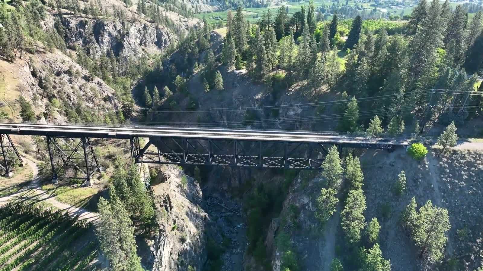
Kendal Ventures flies your vineyard, job site, or property with a precision drone, then turns that one flight into maps, 3D models, and measurements you can actually use. Captured and processed right here in Summerland, by the person who hands you the result.
One flight · Every layer
Don't take our word for it. Open one.
One flight comes back as every layer of the property: a 3D mesh, a measured point cloud, a zoomable map, and a flythrough. These are our own Summerland captures, live in your browser. Move them around. This is exactly what you get back at the end of a job.


These numbers are from our own Blair Street capture:
- 6,052RTK images
- 100%RTK FIX positioning
- 3.6 cmgeoreferencing RMSE
- ≈25 hin-house processing
Who we fly for
Find the one that sounds like you.
Most people come to us for one of three things; start there. The same aircraft and in-house pipeline cover plenty more, too: mining, public works, forestry, ranching, and the land itself.

See the whole block before you walk it
Scout the whole block from the air and walk only the rows that actually matter. One multispectral flight ranks your block into strong, medium, and weak zones: a map you read at a glance, with the index layers underneath for your agronomist.

Measured, not estimated
One flight returns a dated top-down map of the whole site and the volumes to go with it: cut and fill, stockpile counts, nobody on the pile. Flown to RTK accuracy and tied to NAD83(CSRS), so the numbers hold up, and your engineer gets a point cloud that opens in their own tools.

Sell the setting, not just the rooms
We shoot the arrival in the last hour of light (the gate, the rise, the house in its land) then build an interactive 3D tour an out-of-province buyer can walk before they ever fly in. The film sells the feeling; the tour lets them explore it.
Capability index
Eight things one flight can deliver.
The three worlds above are how we package it; this is the full menu. Eight capability groups, every one flown with the two aircraft we run today and processed at our own desk. Tap any card for the work behind it.
Mapping & orthomosaics
True-colour, georeferenced top-down maps you can measure and plan straight off, flown to RTK accuracy.
- Orthomosaics
- Topographic mapping
- Base mapping
- Recurring progress capture
3D models & digital twins
Textured photogrammetry meshes and point clouds you can orbit, measure, and share in any browser.
- Textured 3D meshes
- Point clouds
- Digital twins
- Smart 3D Capture
Terrain & volumetrics
Surface and elevation models, contours, and stockpile volumes derived from a single capture.
- DSM / DTM models
- Contours
- Stockpile volumes
- Cut-and-fill
Crop health (multispectral)
Relative-vigor maps across five indices, plus plant counts and zone maps, for you and your agronomist to read.
- NDVI / NDRE vigor
- 5 indices
- Vine & tree counts
- Zones for review
Visual inspection
High-resolution roof, façade, and asset imagery. See the condition without ladders, for the owner and their contractor to review.
- Roof & façade
- Building envelope
- Asset imagery
- Visual condition
Property media & 3D tours
Cinematic flythroughs, listing media, and interactive 3D tours: the whole property, not just a handful of photos.
- Listing media
- Cinematic flythroughs
- Interactive 3D tours
- Short social cuts
Property records & monitoring
Dated before-and-after records and recurring sweeps: pre-loss baselines, renovation records, and site-progress monitoring on the schedule you set.
- Pre-loss baselines
- Before & after records
- Exterior sweeps
- Ongoing programs
Security, live‑feed & real-time AI
A live aerial feed over your site, event, or perimeter, with the aircraft spotting and counting vehicles and people as it watches. After dark it flies with a mounted spotlight. A loudspeaker is next.
- Live-feed monitoring
- Detection & counting
- After-dark visual response
- Spotlight
Don't see it? Ask. If it can be seen from the air, chances are we can capture it. Read Field Report No. 01 →
Vegetation, wetland, and water imagery is delivered as baseline data for qualified professional review.
The proof
See a real job, end to end.
One page that walks a complete capture from flight plan to final folder: the maps, the models, the report. All of it real, all of it yours to poke at.
Also from Kendal Ventures
We build the websites, too.
The drone work is the main event; the web work is the quieter sideline. We also hand-code fast, easy-to-find websites for local businesses (this very page is one of them) on a simple monthly plan.
On the horizon
Be a founding client for 2027.
A drone spray and spreading program for South Okanagan vineyards and orchards is the next thing we're building, targeting the 2027 season. Founding registration is open now. Put your name on the list, free and with no commitment, and you are first in line when it launches.
- Locally owned and operated
- Transport Canada-certified RPAS pilot
- Captured & processed in-house
- Summerland, BC
Request a quote
Tell us what you're working on.
A vineyard block, a build site, a listing, a roof: tell us what it is and what you're trying to figure out. You'll get a straight answer, a clear scope, and a timeline before anyone flies. One person handles all of it.
Every inquiry gets a reply within one business day. And every job runs the same five steps from scope call to delivery.